
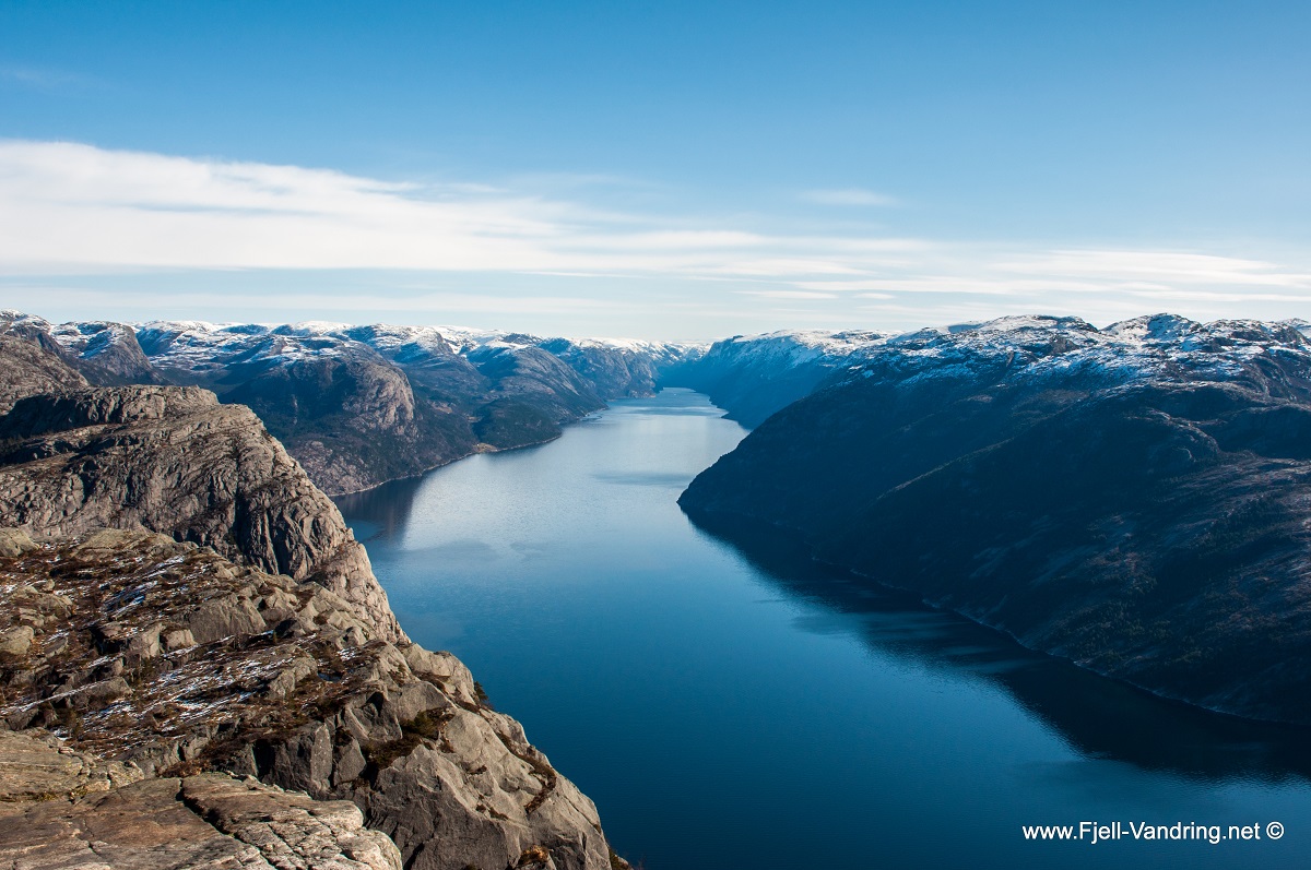
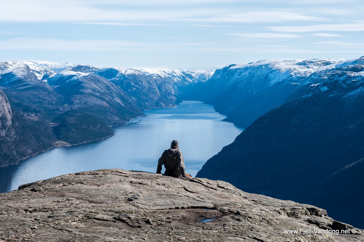
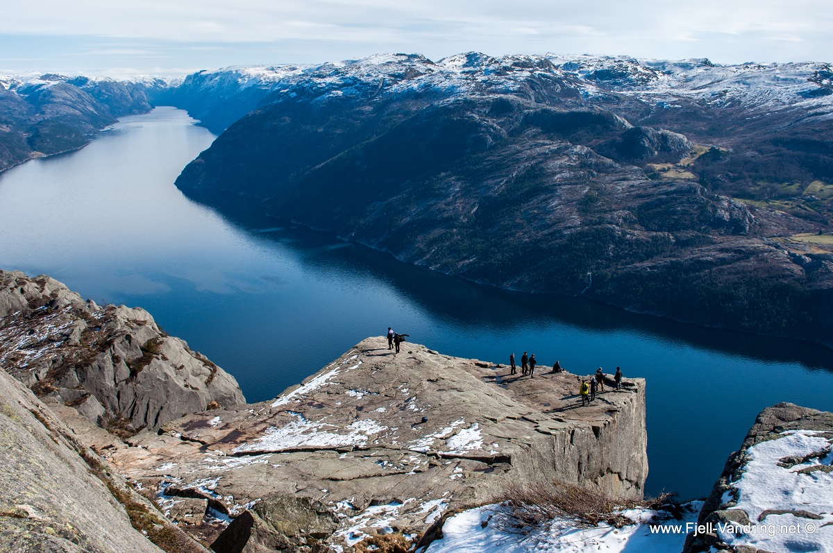
The Pulpit Rock is a well-known hiking destination, not only in Norway, but also in large parts of the rest of the world. Hundreds of thousands visits Pulpit Rock, also known as Preikestolen, every year. The trail has been upgraded by Nepalese Sherpa stonemasons. There is a majestic view over Lysefjorden from the plateau of the Pulpit Rock.
Allow 3.5 hours for the round trip, total length 8.5 km.
NYHETSBREV
Hold deg oppdatert og meld deg på vårt nyhetsbrev.
Vi kommuniserer gode turtips, fellesturer, gode tilbud og annet nyttig informasjon.
Fyll ut påmeldingsskjema og bli med du også! Husk og bekreft epostadressen din (se egen tilsendt epost)!
* Ved påmelding samtykker du til å motta nyhetsbrev fra oss.
Difficulty – Medium
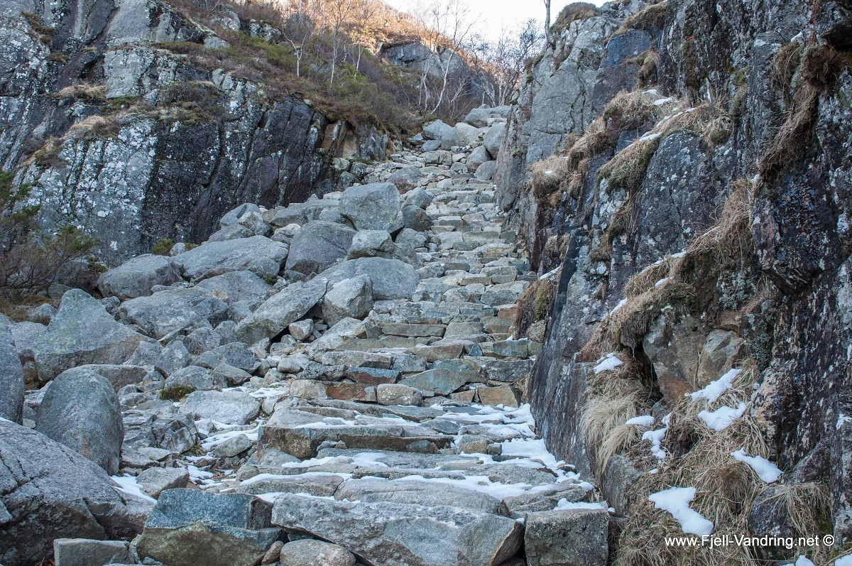
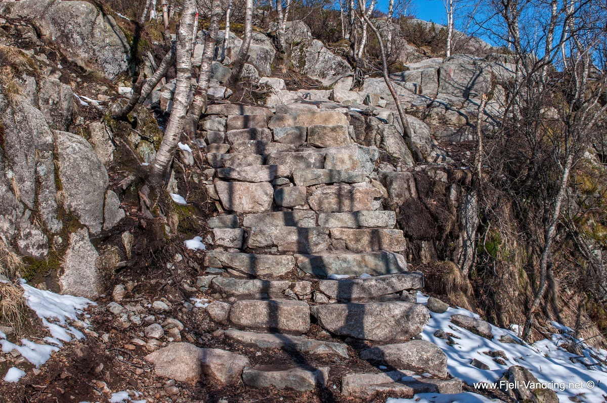
The trip to Pulpit Rock has become a very popular tourist attraction, and has therefore been well adapted both in terms of marking and signs, as well as facilitating the path. In 2013 and 2014, the Sherpas made significant improvements to the path with stairs and stone setting. Where there is no stone set, the trail is good. On the basis of length, ascent, marking and terrain, the trip is graded medium.
Please note that the hike to the Pulpit Rock can be tough if you are not used to hiking. Remember to wear good shoes, bring warm clothes and enough to eat and drink!
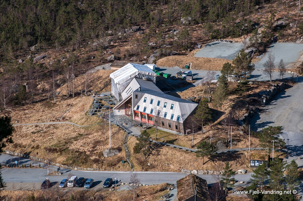
Parking
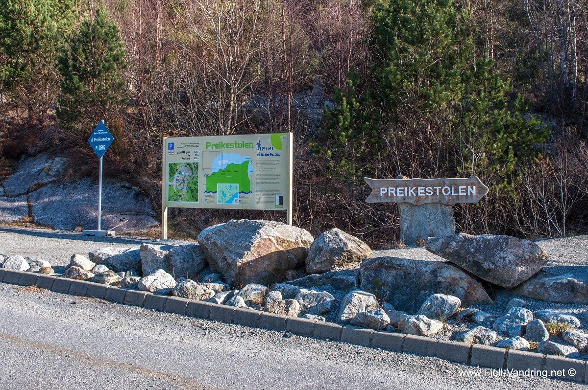
Starting from E39 Sandnes, drive north on the E39 to the Hundvåg tunnel/Ryfast tunnel. Follow the tunnel just Hundvåg and continue through the Ryfast tunnel/Ryfylke tunnel. Take the first exit at the roundabout and follow Ryfylkevegen/Rv13 in a south-easterly direction. The road is followed for approx. 11 km, past Jørpeland and along Botnefjorden where there is a signposted exit to Preikestolen. The exit on the left is so clearly marked that one can not avoid and see it. Follow Preikestolveien for about 5 km and you will reach a large parking lot. Parking fee. GPS position N58 59.515 E6 08.280.
Annonse
Takk til våre samarbeidspartnere
Description of the trip
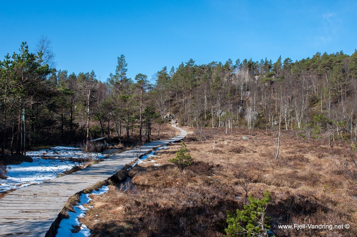
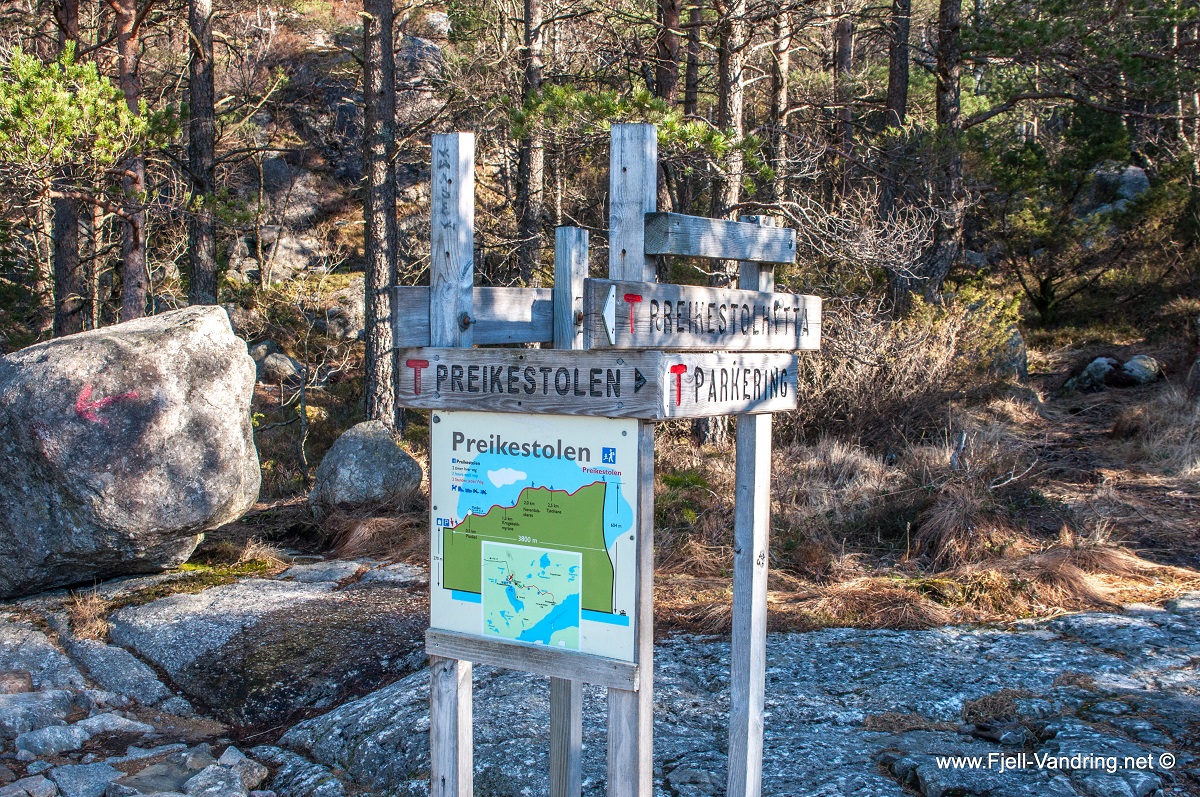
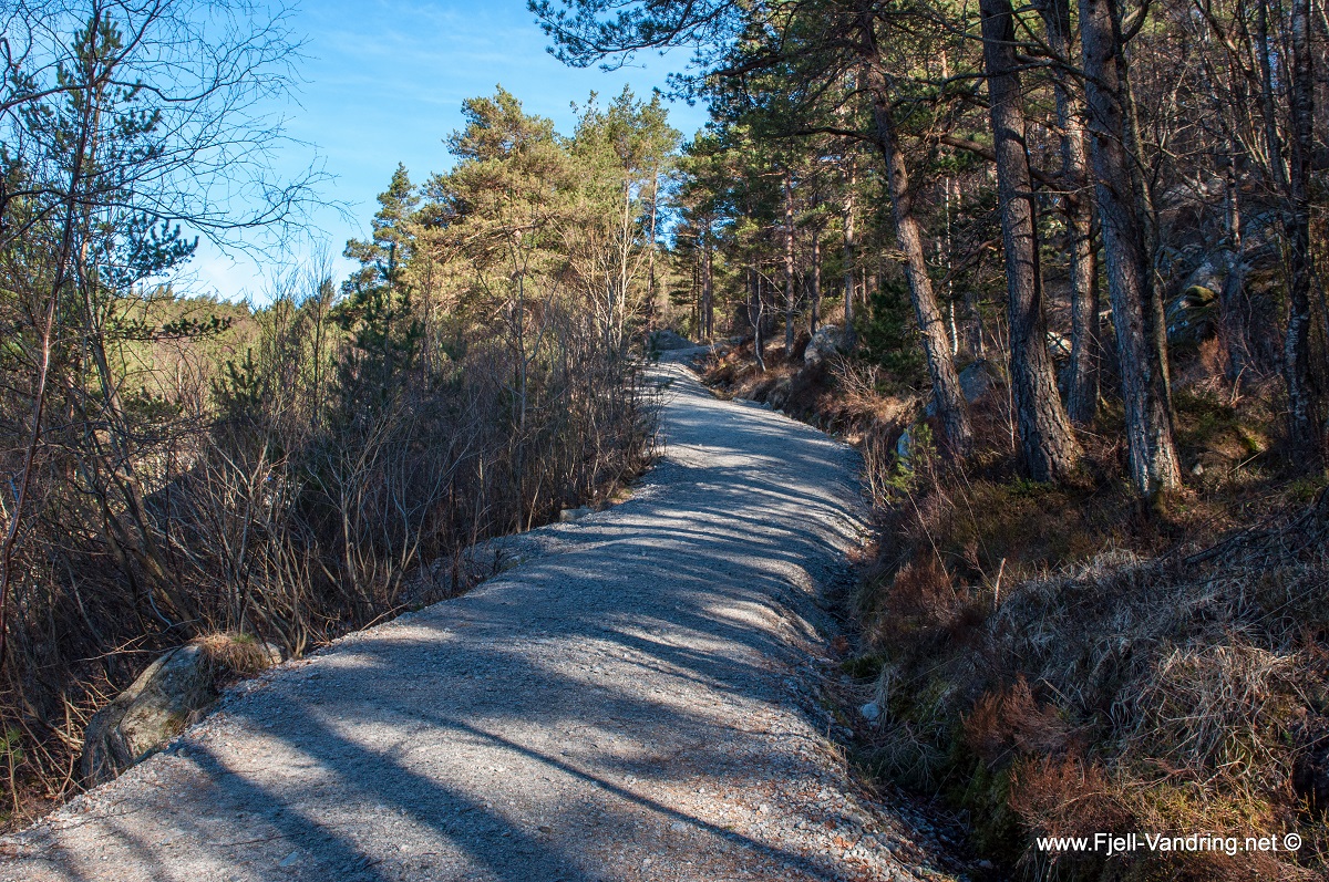
The trip to the Pulpit Rock is both clearly marked and signed. The hike starts from the parking lot, and goes under the road through an underpass. The first uphill starts on a gravel road before it goes into the path. You do not go far before you reach the first sherpa stairs, and at the top of the uphill stands information signs informing both how far you have gone, how far you have left, and which direction you should go.
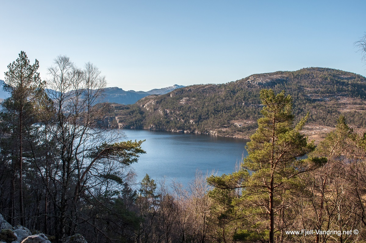
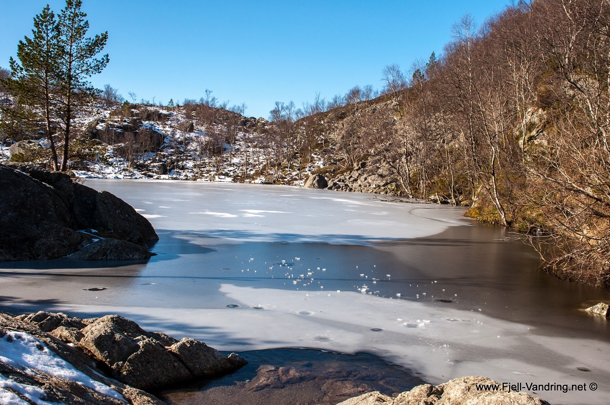
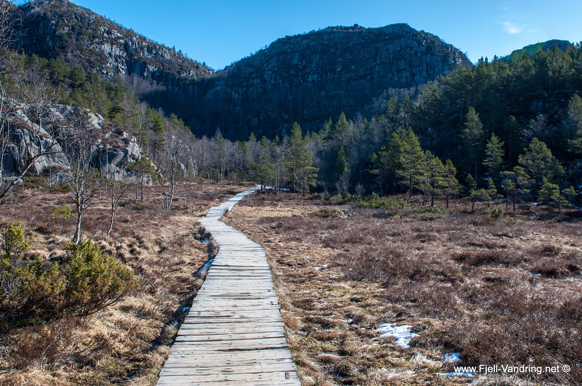
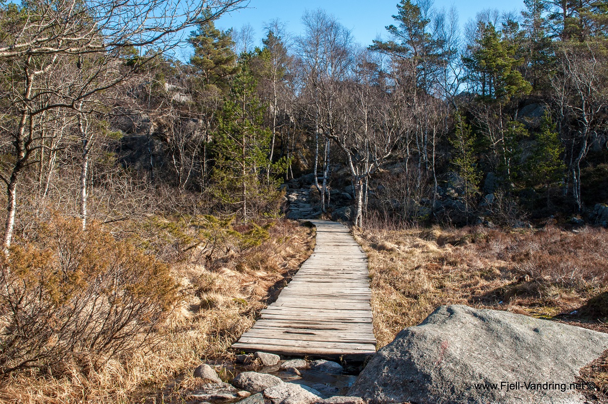
The red T’s clearly show the way in the forest terrain, and Krogabekkmyra is coated with wooden planks to protect the vegetation from trampling. The steep cliff leads us one step closer to the plateau. The Sherpas have built steps up the cliff. The terrain flattens out and several small idyllic ponds are passed, many informative signs about where you are and how long it is left is passed.
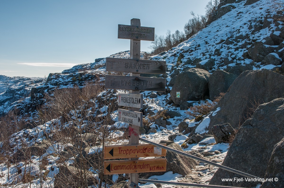
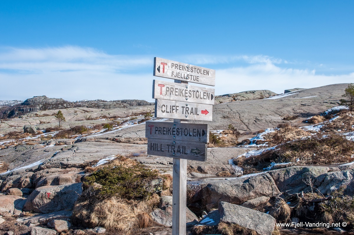
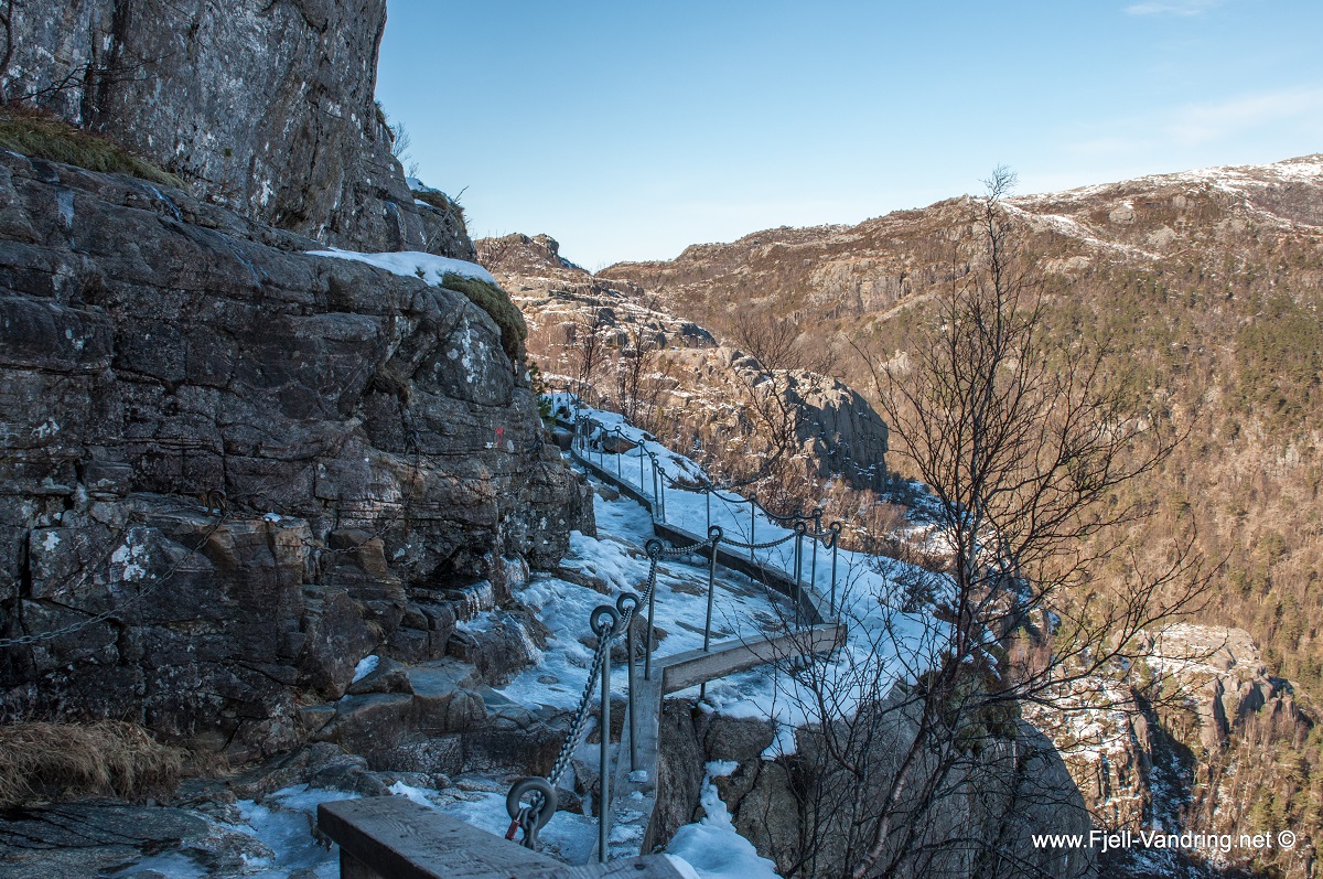
Until now there has been a marked road to Pulpit Rock from Fjellstua, but towards the end it is marked with Cliff Trail and Hill Trail, it is uncertain whether it is still marked with two alternative routes – Cliff Trail is in which case the easiest option towards the plateau. On the last stage, you come to an open steep area, where those with the worst fear of heights often choose to turn around. Here are arranged with fences/chains, and as soon as you have made it past this point the worst is over and you have reached the Pulpit Rock.
I followed the Hill Trail back, and this is also where the GPS track leads, but if you think the Pulpit Rock itself is a demanding hike, I would recommend following the Cliff Trail on the return trip as well. If you are an experienced hiker, the Hill Trail won’t be a problem to follow.
The trip took place in the spring of 2014, dated March 27.
Changes in terrain, marking and signs as well as parking may be different from when we went on the trip. Help us keep the tour page as up-to-date as possible and feel free to report any changes to us.
Map & GPS track
Annonse
Report from our hike
The terrain levels off somewhat and we pass by several small lakes. There has been no shortage of signs indicating our location and distance to the top. Up until now the path has been marked to the Pulpit Rock from Preikestolen Fjellstue, but towards the end of the hike the path is marked the “Cliff Trail” and the “Hill Trail”. Here I meet some Danish hikers who seem a little uncertain, but based on my experience I reassure them that the Cliff Trail is the easier alternative towards the plateau. Still, the icy path on this early spring day makes reaching the plateau demanding. I have brought good crampons with me. It is important to take precautions regardless of the hike.
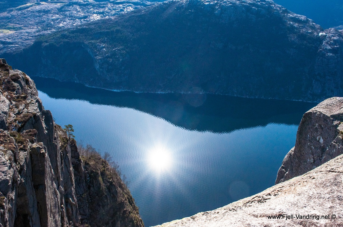
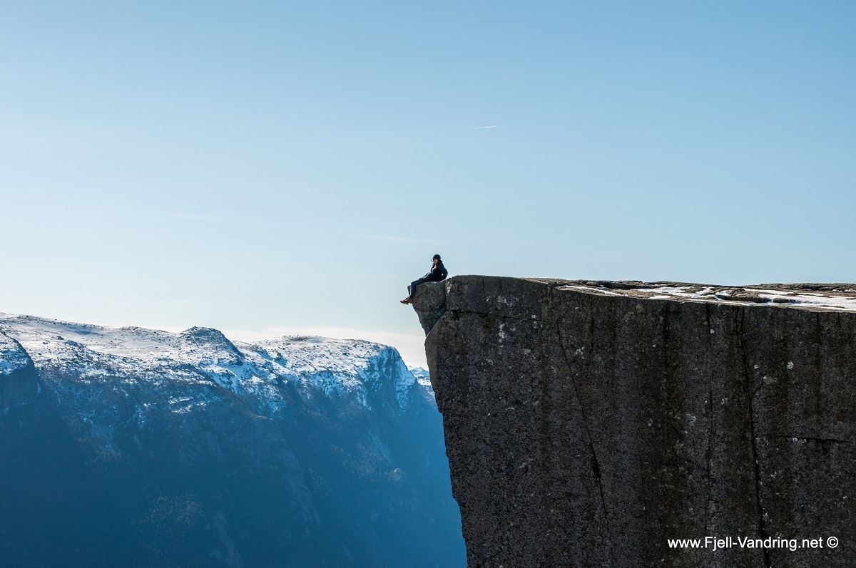
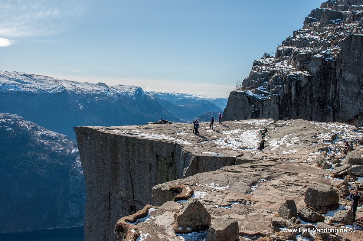
As I am just by the target of today’s trip, I can barely wait to see the view. The only noise I hear, is coming from my own steps. Two ravens float peacefully above my head and observe every movement. The silence is broken when I carefully step onto the 25 x 25 m. plateau. As expected there is already a line-up of “crazy” hikers dangling their feet from the edge, some more challenging than others. I sit down and enjoy a cup of coffee and the sunny view towards Lysebotn.
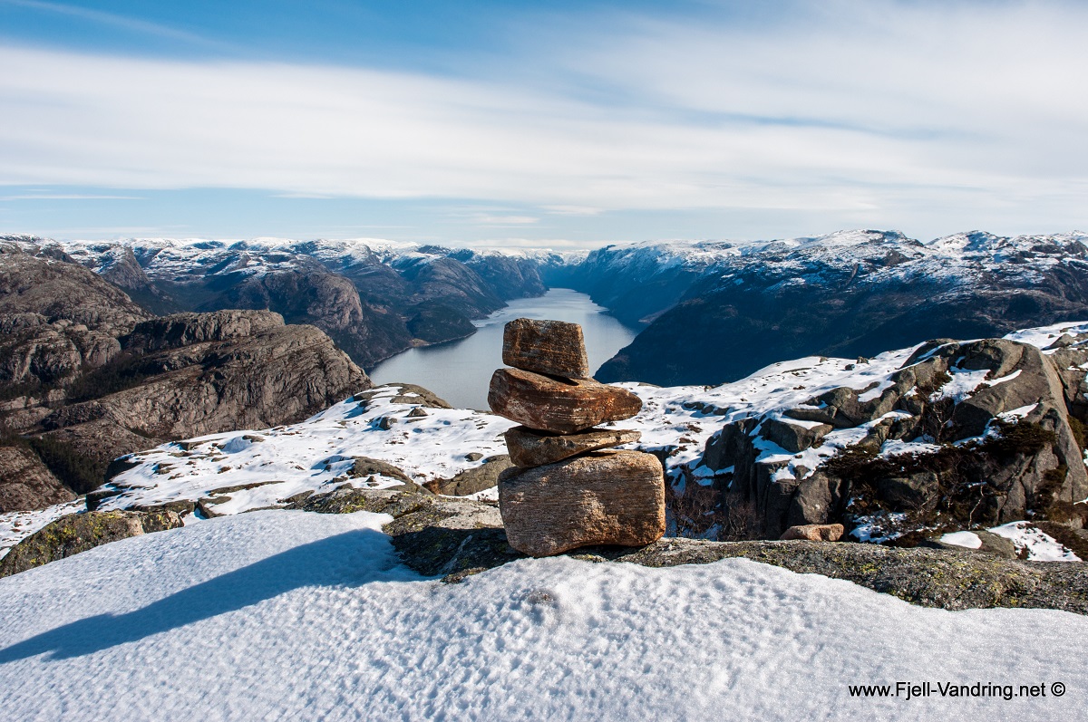
More and more people come to the Pulpit Rock. It’s not peak season yet, but many hikers are already here. Unfortunately I have to start the hike back down. I choose the Hill Trail, and the view just above the plateau is undoubtedly just as magnificent. This path is also marked with red Ts, and offers plenty of airy experiences. I stop to take in the view down towards the Pulpit Rock and Lysebotn.
As mentioned before, the Hill Trail offers some airy and spectacular views, but it is a somewhat heavier trail. I personally find the Cliff Trail an easier route, and recommend this to hikers who find the Pulpit Rock a demanding hiking destination.
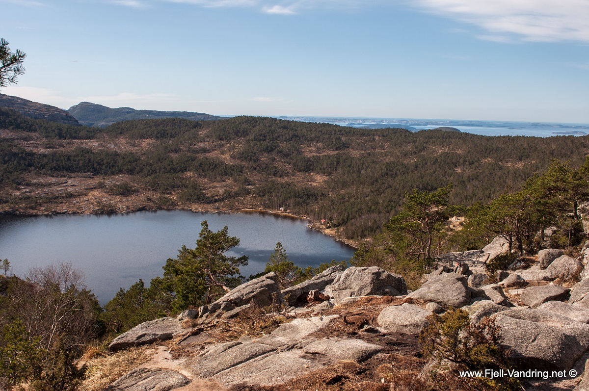
I am down by the path crossing, and from here I continue towards Fjellstua and Preikestolhytta along the same path. Before ending the trip, I sit down by the path just above Revsvatnet and enjoy the view. A great trip in beautiful spring weather is done. I will come back to this area to hike to Troppavatnet and Lammatoknuten.
In addition this area offers several other hikes like Moslifjellet, Neverdalsfjellet and to the cabin Bakken, owned by the Norwegian Trekking Association. Have a nice trip!
The report from our hike is translated from Norwegian to English by Nina Bjørke.
Annonse